
Discussing Physical Features of Pakistan is difficult. It is due to the existence of multiple regions in Pakistan.
Pakistan is one of the few countries in the world that has all regions. It has are mountains, desert areas, snowy areas and plain lands too.
So let’s further discuss Physical Features of Pakistan and it’s regions.
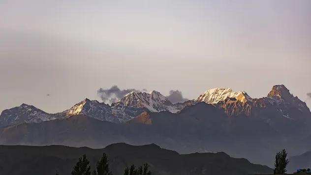
Due to variations in regions, Physical features varies a lot.
For example, you can see a few mountain areas covered with snow. Snowfall throughout the year on these places.
Then there are mountain areas where snowfall isn’t normal but they stay cold throughout the year, then there comes deserts and few more areas that are extremely hot throughout the year and then at the last but not least, there are areas which stay cold and also normal as well.
So if you start to talk about Physical Features of Pakistan, then you should note it down in the very first place that this is going to be a lengthy topic.
Physical Regions of Pakistan are normally divided into 7 categories.
Physical Features of Pakistan – Mountain Areas
Before proceeding further, you must know that where does Pakistan Exist on the World Map. Here’s an image a brought up from a resource, which states few facts about Pakistan.
Pakistan is located in between four countries and the border of Pakistan touches China, India, Afghanistan, Iran. Tajikistan isn’t our direct neighbor but the distance between Pakistan Border and Tajikistan Border isn’t much and they are nearly close to each other.
The longest border that is shared by any country with Pakistan is Afghanistan that is and the second one is India that is .
You may also read the Total Area of Pakistan, that is 796,096KM and Longitude and Latitude as well. The highest point in Pakistan is K-2 Mountain, which is 8611m above Sea Level and Pakistan has the Deepest Level that is 6500m.
Physically Pakistan is divided into 4 provinces, those are Punjab, Sindh, Baluchistan, Khyber Pakhtunkhwa.
So that is a lot of information, let’s discuss the Physical Features that we discussed above.
Western Mountain Areas:
Mountain areas in Pakistan those are on the western side of the country usually stay dry and hot throughout the year, these are not much green or snowy but they grow bushes and grass in the rainy season. People living in these areas usually take their living animals for grazing.
Northern Mountain Areas:
Northern Mountain Areas of Pakistan are one of the most beautiful places in Pakistan to visit.
These places are also one of the remote places, because of the extreme weather conditions and also dangerous routes to reach.
These places have been out of tourist reach for so many years but now lately they are one of the most visited places by the tourist in Pakistan.
These places also include K-2, which is the second highest place on the Earth after Mount Everest. Shahrah-e-Qaraqarum links Pakistan with China & that’s also in Northen Areas of Pakistan.
Baluchistan Plateau:
Baluchistan Plateau is the dryest region in Pakistan, people living in this area have to face a lot of dry weather and due to less water availability, they have to travel miles to get water to their homes and to save them.
This place doesn’t grow much grass but only bushes which have more stinky leaves.
The Salt Range and Potohar Plateau:
The area in Pakistan that is covered up with salt mines are the Salt Range Area and Potohar Plateau of Pakistan.
The land is not wide, and the area is near Rawalpindi. This area has the biggest salt mines in Pakistan. Mines like khewra mine and few others are the famous mines around the world, and also one of the most visited places in Pakistan.
Lower Plain of the Indus:
Located in the southern part of the Indus Plain, the River Indus flows alone. The River Indus flows into the Arabian Sea, in South of Thatta through its distributaries which flow across the Delta River.
Upper Plain of River Indus:
Pakistan most agriculture land exist here, this is the upper plain of River Indus, the land is quite much fertile and a lot of agriculture work is done here. Most of the part in this area is green, hence a perfect place to inhabit. The area is mostly in Punjab, the upper Indus Plain has a height of 180 meters to 300 meters. The number of rivers in this plain is 5.
Coastal Area of Sindh & Baluchistan:
Well, Pakistan holds around of Coastal Area around Sindh and Baluchistan. The longest coastline lies 771 KM in Baluchistan. The Coastal Area of Pakistan are in Sindh and Baluchistan, these coastal areas are with Arabian sea and it connects Pakistan with other countries in the World.
So it sums up to around each and everything with the Physical Features of Pakistan below is some more information about Pakistan that you might like to know.
Karakorum:
The average height of Karakorum is around 6100 meters, but K-2 makes the tallest of them all in Pakistan.
With a hope that you’d liked our article about the Physical Features of Pakistan, we would like you to share it with your friends via social media, just to spread awareness about the beauty of Pakistan.
Contact me on my Facebook Profile ( for anything you want to discuss my blog or you want to add something to this article.
Related Searches:
Physical Features of Pakistan 2018
Physical Features of Pakistan Map
Physical Features of Pakistan Mountains
Location and Geo Physical Features of Pakistan PPT